
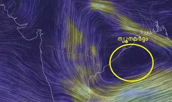
വടക്ക് പടിഞ്ഞാറൻ ബംഗാൾ ഉൾക്കടലിൽ രൂപപ്പെട്ട ന്യൂനമർദം (Low Pressure Area) ശക്തി കൂടിയ ന്യൂനമർദമായി (Well Marked Low Pressure Area) ശക്തി പ്രാപിച്ച് ഒഡിഷ – പശ്ചിമ ബംഗാൾ തീരത്ത് സ്ഥിതി ചെയ്യുന്നു. അടുത്ത രണ്ടു ദിവസം ഒഡിഷ – ഛത്തീസ്ഗഡ് മേഖലയിലേക്ക് നീങ്ങാൻ സാധ്യത.
കേരളത്തിൽ അടുത്ത 5 ദിവസം മിതമായ/ ഇടത്തരം മഴയ്ക്ക് സാധ്യത. ഒറ്റപ്പെട്ട സ്ഥലങ്ങളിൽ ഇന്ന് (14-09-2023) ശക്തമായ മഴക്കും സാധ്യതയെന്ന് കേന്ദ്ര കാലാവസ്ഥ വകുപ്പ് അറിയിക്കുന്നു.
2 pm, 14 സെപ്റ്റംബർ 2023
IMD-KSEOC-KSDMA
————————-
A Well Marked Low Pressure Area lies over Northwest Bay of Bengal & adjoining North Odisha-West Bengal coasts. It is likely to move across Odisha and Chhattisgarh during the next 2 days.
A cyclonic circulation over southeast Uttar Pradesh & adjoining northeast Madhya Pradesh in lower tropospheric levels.
Light/moderate fairly widespread to widespread rainfall with isolated heavy rainfall very likely over Kerala on 14th September.